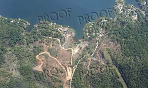
REMOTE SENSING
Remote Sensing is now a viable method of information collection that significantly enhances the more traditional BOYLE engineering services. Advances in digital imaging technology, improved optics, and unmanned systems have made this possible. These services are offered to other engineering firms across the region who could benefit from this highly innovative capability.
BOYLE utilizes small unmanned aerial vehicles which is used for smaller job sites. The unmanned aircraft is used for applications demanding a more intimate, higher resolution, photo/ video experience at lower altitudes, where nearby airports, obstructions, vehicles/pedestrians, and radio frequency interferences are not present. BOYLE also goes “ABOVE & beyond” in recognizing both the security and privacy considerations when utilizing this capability.
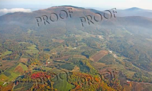
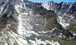
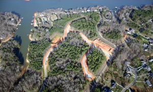
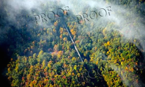
BOYLE owns and operates a Cessna C210 aircraft which is used weekly to collect both photo and video data across the Carolinas. The aircraft enables us to collect oblique and vertical aerial photos and video.
The aircraft can fly at speeds of nearly 170 mph and; therefore, a wide geographic range can be covered quickly to get the information our clients need.

Using aerial photography to analyze, document, and communicate, InSiteful Imagery is a web map tool offering a complete geospatial analytical solution for the non-GIS professional site assessor. Aerial-derived data is collected, processed, and served to our clients in an easy-to-use web map that can be accessed, with no specialized software required, from both desktop and mobile devices. Insiteful Imagery can be used to provide aerial images for a single instance, on a regular schedule, or as rapid response after a disaster, and much more!
Aerial Photography Galleries
Take a look at our photo galleries for some insightful aerial perspectives of places here and abroad.
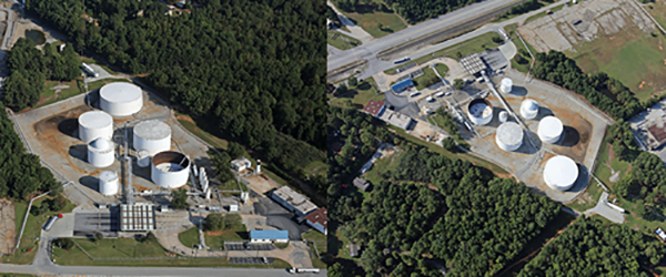
Oblique Aerial Photograph
An oblique aerial photograph is taken at an angle towards the earth; if the angle is almost straight down, it is considered steep. An oblique aerial photograph that shows more of the sides of buildings is considered low or shallow.
*Views of petroleum storage tank farm used for inventory monitoring
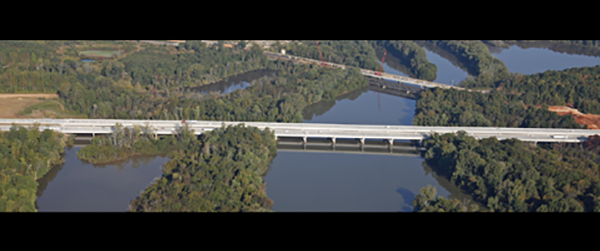
Aerial Panorama
An aerial panorama is created by stitching two or more oblique aerial photos taken in sequence. The final effect is a large wide oblique view not otherwise obtainable with a single camera exposure.
*Long bridge across the Yadkin River
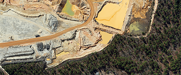
Vertical Aerial Photograph
A vertical photograph is taken by pointing the camera lens straight down, perpendicular to the earth’s surface.
*Property boundary at sand and gravel pit
Vertical Mosaic Aerial Photograph
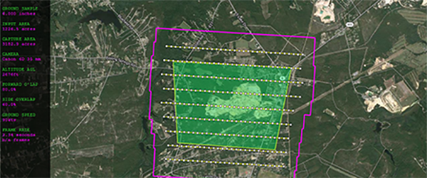
Larger areas of the earth are imaged by stitching, or mosaicking, two or more individual vertical photos together. This is done to preserve the resolution of features in the final image rather than simply fly higher.
*Screen shot of mapping required to produce mosaic
Orthophotograph
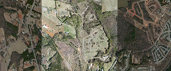
An orthophotograph is made by “flattening” the vertical or vertical mosaic aerial photograph into an orthogonal map projection so that a distance scale can be assigned and features in the image measured. An orthophotograph can be printed but they are more commonly used in various mapping/ design software programs (Computer-Aided Design-CAD, or Geographic Information Systems-GIS).
*9 inch GSD (Ground Sample Distance) orthophoto over 24 inch GSD satellite imagery
Custom Maps
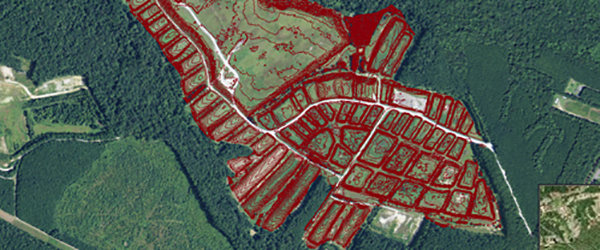
Topographic contour maps can be prepared for your project site by preparing a Digital Elevation Model (DEM-see below) and connecting points of equal elevation. Other maps are prepared by extracting image feature data using GIS tools from an orthophotograph. Our InSiteful web-map service allows the client to make their own maps as needed.
*View of topographic contours overlying an orthophotograph
Aerial Video
Full service aerial video media production (Crisp, stabilized, High Definition aerial video can be produced, including professional scripts, narration, and combined with appropriate music) through our partnership with Award-winning Streamwerx. Depending on project needs, video is collected from airplane, helicopter, or a Small Unmanned Aerial System (sUAS).
*Promotional video created for new mountain community
3D Pixel Reconstruction Models
A 3-dimensional (3D) model can be prepared by combining multiple aerial photographs (oblique and vertical) using software that matches image pixels to create a “point cloud” containing 3D information. A colorized version of the model can be manipulated on a computer to visualize and measure features in any direction. The 3D file user must have the appropriate software to view the model.
*Screen shot of 3D model created for remote facility visualization
Large Prints
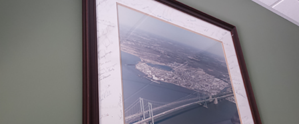
Prints of any 2D product can be made on paper, canvas, or metal.
*These are ideal for office décor and send-off gifts
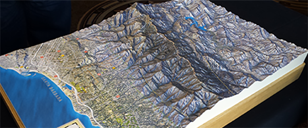
Solid Terrain Models
Orthophotography can be used in conjunction with elevation information to create an accurate colorized solid terrain model that can be displayed and viewed. Many of these are used in the visitor center at state parks, national forests, etc. (www.solidterrainmodeling.com)
*Photo of table-top model displayed at US Forest Service Ranger station
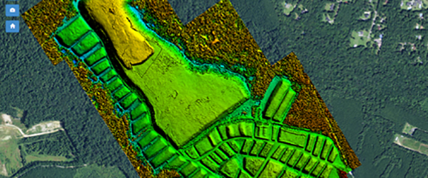
Digital Elevation Models (DEM) w/ Volume Computation Report
A DEM of the earth’s ground surface is used to create various maps such as topographic contours or compute earth volumes like construction earthwork, landfill volumes, large excavations, mining reserves, or stockpiled materials. DEMs produced from the same area can be used to calculate and provide a Volume Computation Report.
*Screen capture of colorized DEM in map service
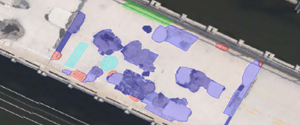
Spatially-Integrated Small Format Aerial Photography (SI-SFAP**) w/Condition Assessment Report
Sub-inch resolution (pixels in the image represent less than on inch on the ground surface) imagery is used to perform custom image interpretation and visible feature extraction to assess the condition of horizontal surfaces. The resulting data is compiled into a report by our Subject Matter Experts in the fields of bridge inspection, roofing, and pavements.
*Screen capture showing analysis of sub-inch GSD image of bridge deck
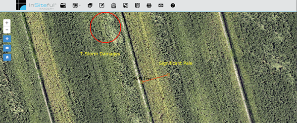
Custom Image Interpretation and Reporting
Aerial photography is collected as specified by the client. The imagery is used by our Subject Matter Experts to prepare a custom report; examples include a construction monitoring report which would detail people/ vehicles on site, type of construction equipment on site, site conditions, activity, erosion, etc.
Boyle Consulting Engineers 2016. All Rights Reserved | Website Designed & Developed by Adhesive Designs & Layers Theme
